Written by

More entries in

  1. 2023
  2. 2D seismic
  3. Depth imaging
  4. Machine learning
  5. Publications

Download the publication

Velocity model updates using machine learning

pdf_icon

Cameron, G.H., 2023, PSDM velocity model building using a Deep Convolutional Neural Network, CSEG Recorder.

Building PSDM velocity models in complex structure land environments is difficult. A machine-learning method using a convolutional neural network (CNN) incorporates both human and artificial intelligence to overcome these difficulties. The supervised learning process used a large representative dataset to train the CNN, learning the convolutional weights that best map the input seismic shot records to the target velocity model. With careful consideration of both training data and network architecture, the CNN can accurately predict velocity models on both synthetic and field data.

Discussion

No comments so far

Written by

More entries in

  1. 2022
  2. 2D seismic
  3. Anisotropy
  4. Depth imaging
  5. Publications

Download the publication

Structural Geology is a Key to Seismic-Imaging Success

pdf_icon

Vestrum, R.W. and MacArthur, T.R., 2023, Structural Geology is a Key to Seismic-Imaging Success, AAPG Explorer.

  • Seismic data in structured land areas are characterised by low data density, low signal-to-noise ratios, and high structural complexity
  • Automated methods for velocity model building break down under these conditions
  • Structural-geology constraints are key to seismic imaging success in these areas, as illustrated graphically with this fault-geometry scenario test

Discussion

No comments so far

Written by

More entries in

  1. 2022
  2. 2D seismic
  3. Anisotropy
  4. Depth imaging
  5. Machine learning
  6. Publications

Download the publication

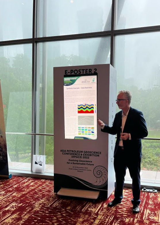
APGCE 2022: Convolutional neural networks to augment PSDM velocity model building

pdf_icon

Cameron, G.H. and Vestrum, R.W., 2022, Convolutional neural networks to augment PSDM velocity model building, APGCE Conference, Kuala Lumpur, Malaysia

  • Built convolutional neural network (CNN) to estimate TTI PSDM velocity models from shot gathers
  • Traditional automated methods for PSDM velocity estimation in complex-structure land areas are unstable, so we rely on the human understanding of the geology to build geologic models
  • The goal is to use machine learning to supplement human learning
  • Field-data example shows imaging improvements on certain shallow reflectors, which shows the potential of the method

Poster presentation

Greg presents poster in Kuala Lumpur

Discussion

No comments so far

Written by

More entries in

  1. 2022
  2. 2D seismic
  3. AAPG
  4. Anisotropy
  5. Colombia
  6. Depth imaging
  7. Publications

Watch the video

AAPG ICE 2022: Structural Styles: Challenges in Seismic Imaging

Vestrum, R.W., and Cameron, G.H., 2022, Structural Styles: Challenges in Seismic Imaging, AAPG ICE 2022, Cartagena, Colombia

This presentation develops the themes presented in Chapter 2 of the AAPG publication, Andean Structural Styles: A Seismic Atlas. Seismic data in areas like the Andes have unique challenges that break traditional seismic-imaging methods designed for offshore exploration. Reducing exploration risk in these basins requires a workflow tailored to the geologic setting. The under-constrained nature of the seismic data requires tight integration with the structural geologist.

Seismic imaging is a vital tool for mapping the complex geologic structures of the Andes. The method of imaging the Earth’s subsurface with seismic waves is powerful, and it has certain limitations—especially when deployed in complex-structure land areas like the mountain ranges and high plains of the Andes. Understanding the technologies involved and how they are applied to this specific geologic setting will improve our understanding of the risks and uncertainties involved in the interpretation of structures on seismic images.

Seismic data in thrust-belt environments are typically low data density and have low signal-to-noise ratios, all while attempting to image complex geologic structures. The data are acquired over rough topography with laterally varying velocities from the surface down. If the near surface is the lens through which we image the subsurface, our lens is bumpy and distorted. These are the challenges of seismic processing in fold thrust belts, and decades of technology development has gone into facing those challenges, from weathering corrections for the near-surface, to advance migration algorithms that can image below major thrust faults.

Discussion

No comments so far

Written by

More entries in

  1. 2019
  2. 2D seismic
  3. AAPG
  4. Anisotropy
  5. Case history
  6. Colombia
  7. Depth imaging
  8. Peru
  9. Publications

Download the publication

AAPG ICE 2019: Geologically constrained seismic imaging in Andean thrust belts

pdf_icon

Vestrum, R.W., 2019, Geologically Constrained Anisotropic Depth Imaging in Andean thrust belts, AAPG ICE, Buenos Aires.

  • Seismic data in structured land areas have severe limitations
  • Geologic interpretation and human collaboration can overcome these limitations
  • Examples from Colombia and Peru show how we resolve these issues through geoscience collaboration
  • Increased accuracy of an imaging algorithm also means increased sensitivity: PSTM → PSDM → RTM

Discussion

No comments so far

Written by

More entries in

  1. 2017
  2. 2D seismic
  3. Anisotropy
  4. Case history
  5. Depth imaging
  6. Myanmar
  7. Publications

Download the publication

CSEG Recorder 2017: Myanmar PSDM case history

pdf_icon

Vestrum, R.W., Gonguet, G., and MacArthur, T., 2017, Geologically Constrained Anisotropic Depth Imaging in the Central Burma Basin, Onshore Myanmar, CSEG Recorder.

  • 2D seismic imaging along the foothills of the Indo-Burma range
  • Interpretive geologic constraints required for model building in noisy seismic data
  • Resulting seismic images showed structural details that time processing could not fully image.

Discussion

No comments so far

Written by

More entries in

  1. 2015
  2. 2D seismic
  3. 3D seismic
  4. Depth imaging
  5. Peru
  6. Publications

Download the publication

EAGE Madrid 2015: Creating a 3D Geologic Model for 2D Depth Migration in the Peruvian Andes

pdf_icon

Vestrum, R.W., Vilca, J., Di Guilo Colimberti, M., 2015, Creating a 3D Geologic Model for 2D Depth Migration in the Peruvian Andes, 2015 EAGE Conf & Exhibition, Madrid, Spain.

  • Consistent velocity model across multiple 2D lines by building the velocity model in 3D
  • Interpretive 3D velocity model minimized misties at line intersections
  • Final PSDM results removed subthrust velocity pull-up

Discussion

No comments so far

Written by

More entries in

  1. 2012
  2. 2D seismic
  3. Publications

Download the publication

AAPG Explorer: Why 2D lines do not tie when beds are dipping

PDF download

Vestrum, R.W., 2012, In overthrust settings, tie, tie (2-D) again, AAPG Explorer, August 2012, p 38.

  • Discusses the interpretation pitfall of trying to tie 2D lines
  • Offers a strategy to try to overcome the 2D line-tie problem
  • We changed the title after publication to something more descriptive than the title assigned by the editor

Discussion

No comments so far

Written by

More entries in

  1. 2012
  2. 2D seismic
  3. Case history
  4. Depth imaging
  5. Publications
  6. Time processing
  7. Turkey

Download the publication

IGC Istanbul 2012: 2D case history from southern Turkey

pdf_icon

Vestrum, R.W., Layzell, M., and Gittins, J., 2012, Seismic imaging and interpretation over Antep Block, southeast Turkey: Istanbul Internat. Geophys. Conf., Istanbul, Turkey, 17-19 September 2012.

  • Time and depth imaging of 2D data over extensional tectonics.
  • Highlights importance of collaboration between interpretation and processing teams.

Discussion

No comments so far

Written by

More entries in

  1. 2009
  2. 2D seismic
  3. 3D seismic
  4. Depth imaging
  5. First Break
  6. Publications
  7. Time processing

Download the publication

2009 First Break article illustrates our focus on geophysics fundamentals

pdf_icon

Vestrum, R.W., and Gittins, J.M., 2009, Technologies from foothills seismic imaging: replacements or complements?: First Break, 27, no. 2, 61-66.

  • The editor describes this paper: “Our land seismic section begins with a provocative article challenging the assumption that only new technologies will do.”
  • Sven Trietel suggests that this philosophical discussion “ought to be made ‘must’ reading for any newcomer to our game.”

Discussion

No comments so far

← Older Entries